 REAL TRAIL NAME: Big Santa Anita Canyon Loop ~ with Upper Trail
**THIS HIKE DETAILS PAGE IS NOT UP TO DATE YET**
LAST HIKE DATE: Saturday, January 11, 2014
MEETING TIME: 6:00am
(We’ll wait 15 mins past the meeting time. We’ll be leaving at exactly 6:15am to our next spot so we can consolidate our car-pooling)
HIKE LEAD: TBA
HIKE LEVEL: Level 7 – No Beginners
WHAT IS A HIKING LEVEL?:
Find out more about hiking levels here:
http://latrailhikers.com/about/hike-levels/
DISTANCE: 9 Miles approx. (Round trip)
ELEVATION GAIN: about 1400 feet
HIKE DURATION: Approx. 6 hours
MEETING LOCATION:
ARCO Gas Station / AMPM
5 W Foothill Blvd.
Arcadia, CA 91006
WATER REQUIRED. WATER CHECK WILL BE PERFORMED. If you do not take enough water or are not appropriately equipped for this hike, you will be turned away from doing this hike with us even if you show up. Please note, that we have expectations for Level 7 evening hikers. Read all the details in the link above.
REQUIRED: WATER. At least 2 to 4 Liters of water, comfortable hiking shoes and a few good snacks.
RECOMMENDED: Extra water besides the 2-4 liters in your hydration packs, one or two half-liter bottles of Gatorade or electrolyte-based drink should do. Bring extra food, sun screen protection, a hat, sun glasses, and bug repellent.
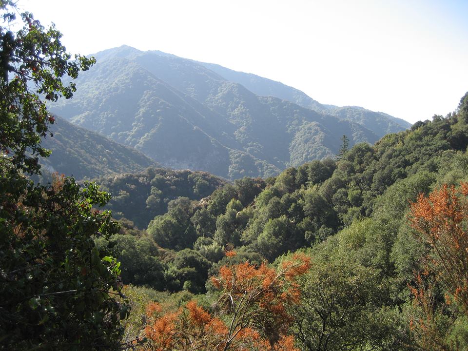
HIKE WALKTHROUGH: After we meet up, we will drive to the Chantry Flats area. From there, we will head down the first part of the trail which is asphalt but eventually turns to dirt. We will then cross a neat Green Bridge, this being the beginning of the Gabrielino Trailhead. We will then reach the Junction for the Upper and Lower GabrielinoTrail. We will take the Lower Gabrielino Trail for about 2 ¼ miles. This will lead us past the 55ft high Sturtevant Falls to Spruce Grove Campground where we will take our 1st break. Less than a mile from Spruce Grove Campground is the historical Sturtevant Camp. From there, we will head out to the Upper Zion Trail Junction. Once there, we will follow this trail for 1 ¼ miles until we reach the Mt. Zion summit where we will take our 2nd break. We should have a great view of the towers at the top of Mt. Wilson. We will then head back down for the next 1.5 miles or so, a large part of this being in the sun. We will then reach the Lower Zion Trail Junction where we will take the Lower Winter Creek trail where we will end up going back up the asphalt trail we came down at the beginning of the hike.
NOTES FROM THE HIKE LEAD:
* No Beginners
* No dogs
* Please take the time to check out the event page on Facebook. I am the type of Hike Lead that likes to post updates and informational pieces leading up to the hike. If you do not have a smart phone or are not on Facebook, it is your responsibility to gain access to the event page on Facebook, at least the night before or morning of, and check if any UPDATES have been made. It is your responsibility.
* If you have plans on splitting from the group, please don’t attend this hike.
* If you have time constraints, please don’t attend this hike.
* Pack lots of water for this longer trail
* The trail is well-maintained and marked but it’s a good idea to have a map. You can pick up a free one at the Adams Pack Station.
* Plenty of poison oak is scattered along this trail—make sure you know what it looks like before you go.
* During the summer months, this trail is hot in some areas. Many hikers wear convertible pants that can unzip to convert to shorts.
* While hiking the warmer, dryer parts of the trail, keep an eye out for rattlesnakes
PARKING FEE: $5 Day or $30 annual Adventure pass. Please get this ahead of time from a local Sports store like REI stores, Big 5 Sporting Goods, and other retailers prior to the hike. Also note, that the Adventure pass is now available at the meeting point (AMPM). When parking in Angeles National Forest mountain-side, make sure you park within the white lines. Not on the line, but inside. Or you can expect a ticket, even if you have your Adventure Pass.
HOW DO I PARTICIPATE WITH THE GROUP ON THIS HIKE?
1. Read the Hike’s Details we link at the very top of this page.
2. Make sure that the Hike Level accommodates your hiking experience.
3. If, and only if it suits you, then RSVP for this event and show up the day of the hike with all necessary gear and water (we mention everything you need on the details page for this hike).
MY FRIEND SAID I CAN DO THIS HIKE, I SHOULD BE ABLE TO DO IT, RIGHT?
Contrary to popular belief, you know your body and hiking experience better than your friends. Whether you are a first-timer or an experienced hiker, please read our hike details page as the hike may not suite your experience level. We have a better experience if every hike has hikers of the intended level.
IS IT DOG-FRIENDLY?: Although dogs are allowed in the area, we are requesting NO pets for this level hike.
RSVP:
Facebook – https://www.facebook.com/latrailhikers/events
DISCLAIMER: LA Trail Hikers and its Leads/Organizers/Participa
MAP: